


- 2 Ağustos 2021
- 15173 defa okundu.
Finalist, Taksim Kentsel Tasarım Yarışması
R E – T A K S İ M
TÜRKÇE ÖNSÖZ
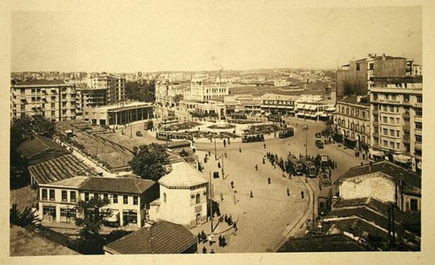
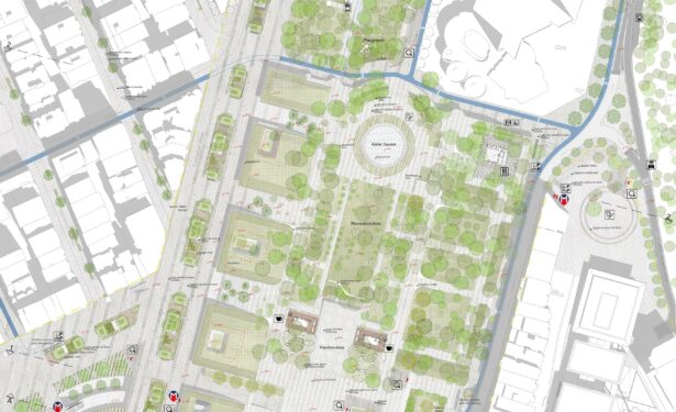
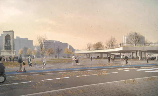
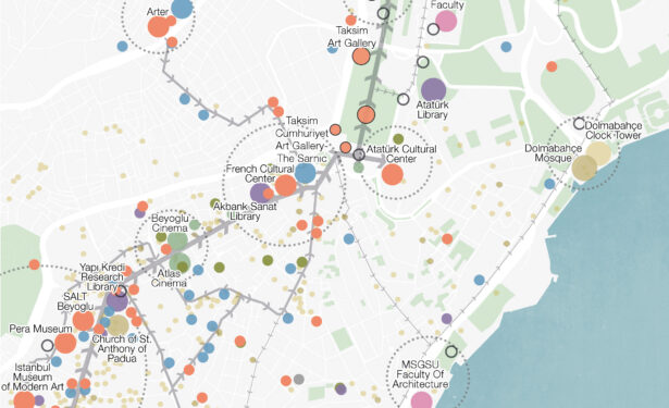
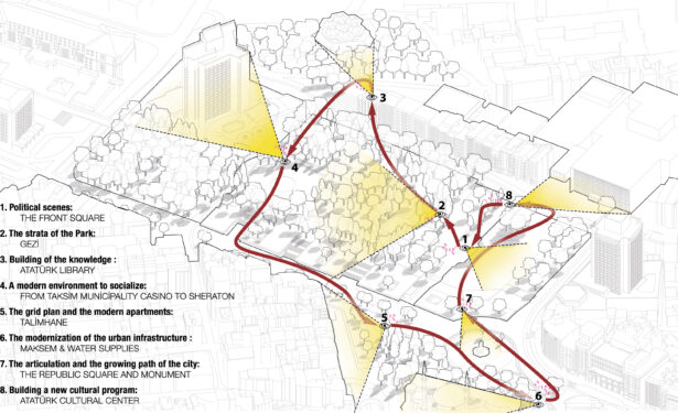
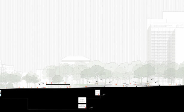
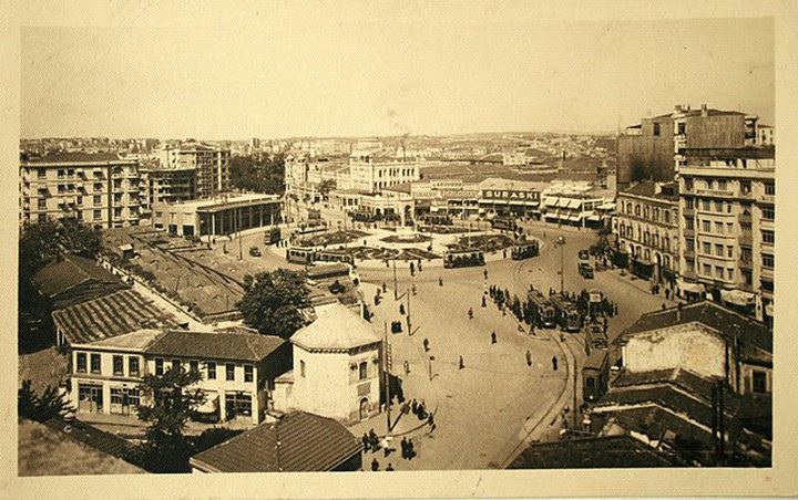
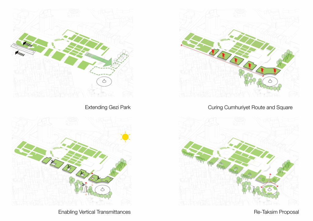
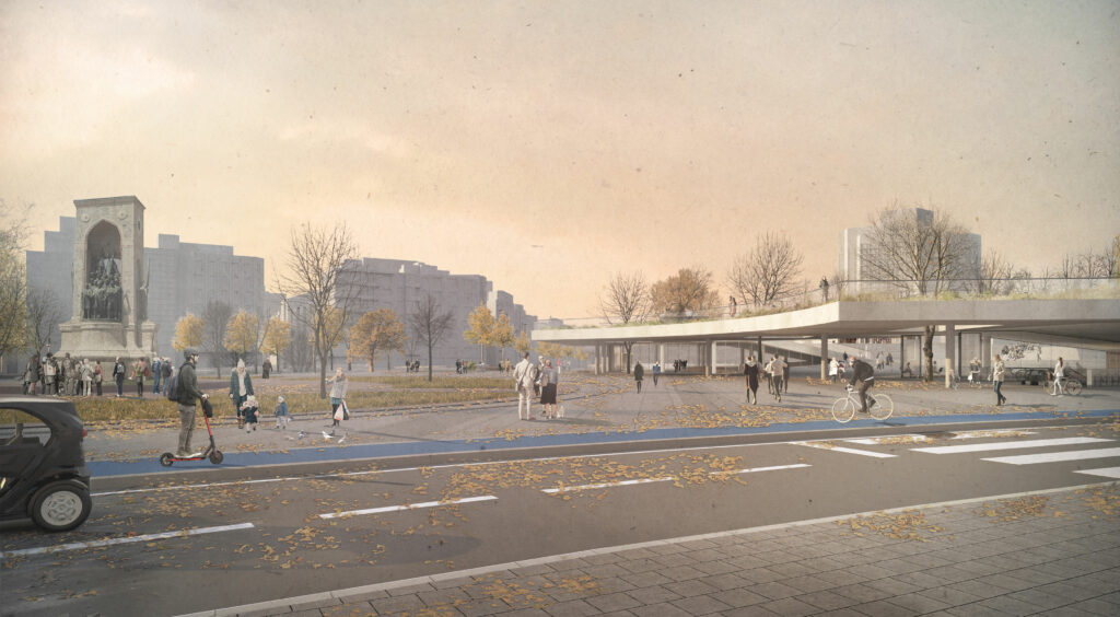
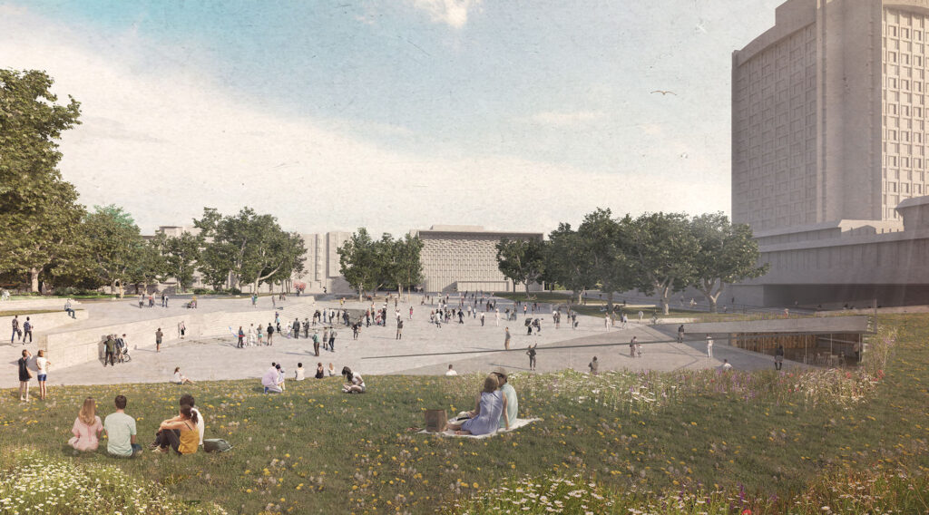
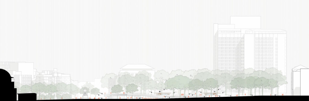
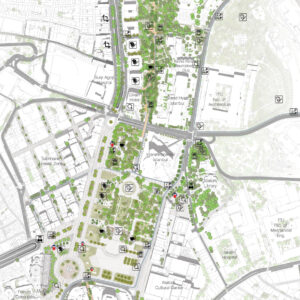
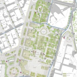
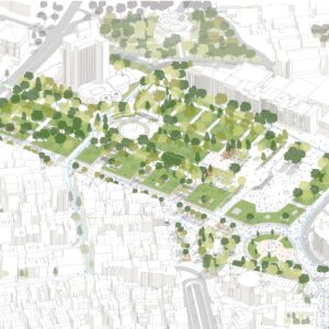
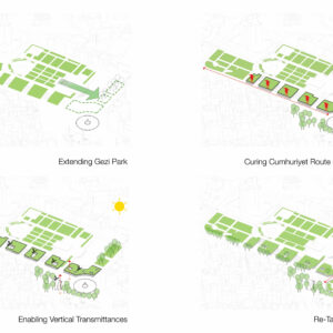
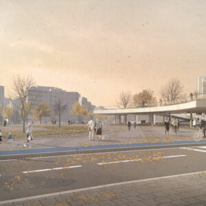
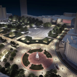
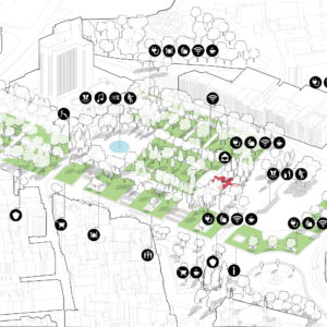
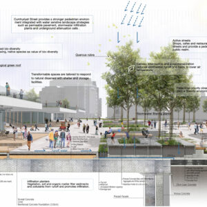
Taksim Meydanı’nın tarihini incelediğimizde, özellikle de Cumhuriyet Anıtı ve çevresi ilk düzenlendiğinde fiziksel mekân çok sorunlu görünmüyor. Ama Anıt’ın 1928’deki inşasından sonra 1940’ta Prost Planı ile başlayan yıkımlar, 1986’daki Tarlabaşı Yıkımları ve 2013’teki Yayalaştırma Projesi ile yolların da ortadan kalkması sonucu kentsel doku tamamen çözülüp tanımsız bir sert zemine dönüşüyor. Bu noktada kentlilerin oryantasyonunu, kentsel açık alan sekanslarının artikülasyonunu ve Anıt odaklı meydanın ölçeğini/sınırlarını kaybettiği, Anıt’ın yüzmeye başladığı bir kentsel garabet ile karşı karşıya kalıyoruz. Ama bu noktadaki çözüm arayışlarında yapılacak en yanlış tercih de AKM’nin bir çekim merkezi olarak güçlendirilmesi ya da Cumhuriyet Caddesi’ni kapatarak meydanı tanımlamaya çalışmak. Çünkü Taksim şu an 19. yüzyıl sonundaki gibi kentin bittiği yer de değil.
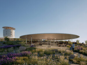
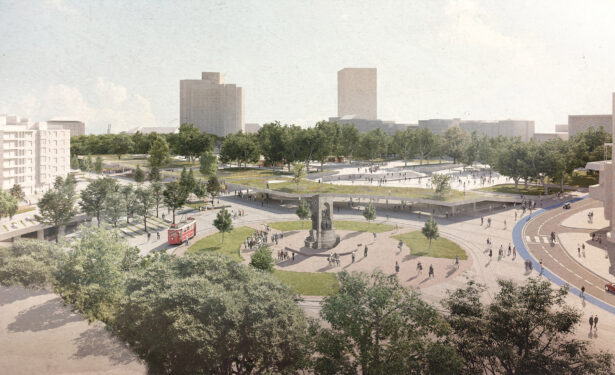
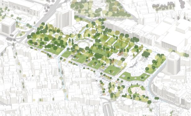
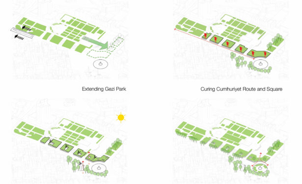
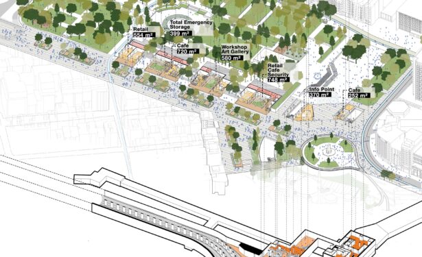
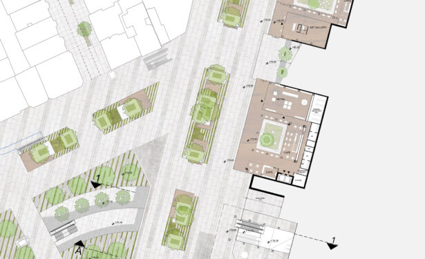
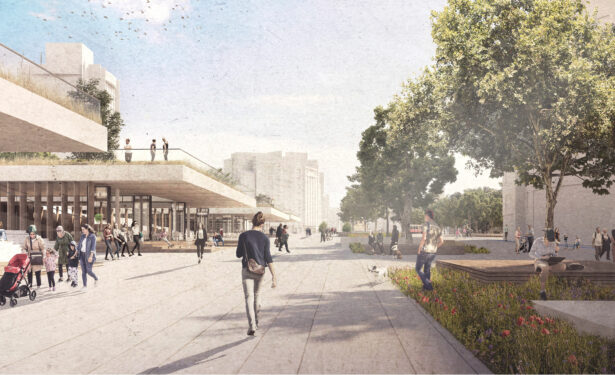
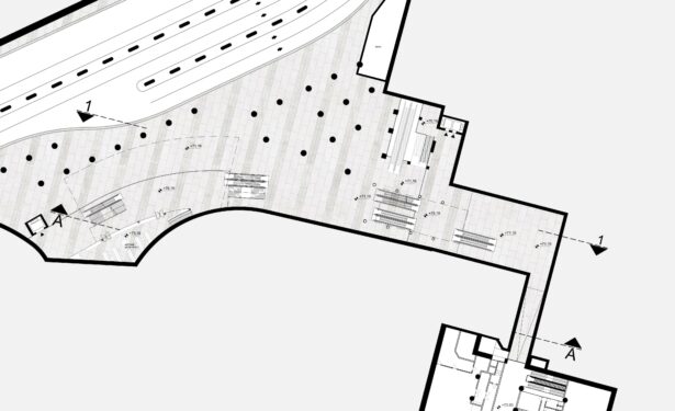
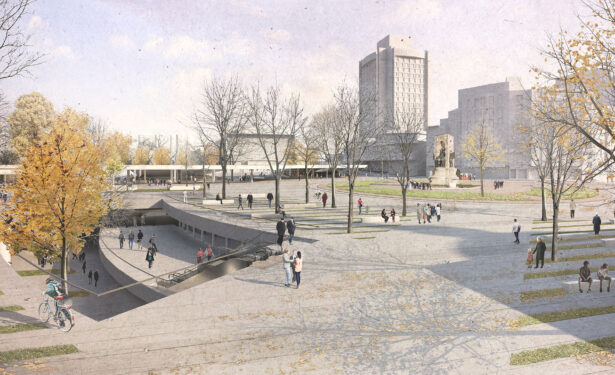
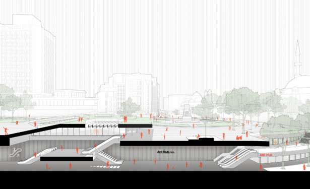
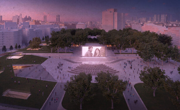
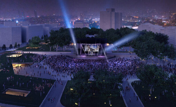
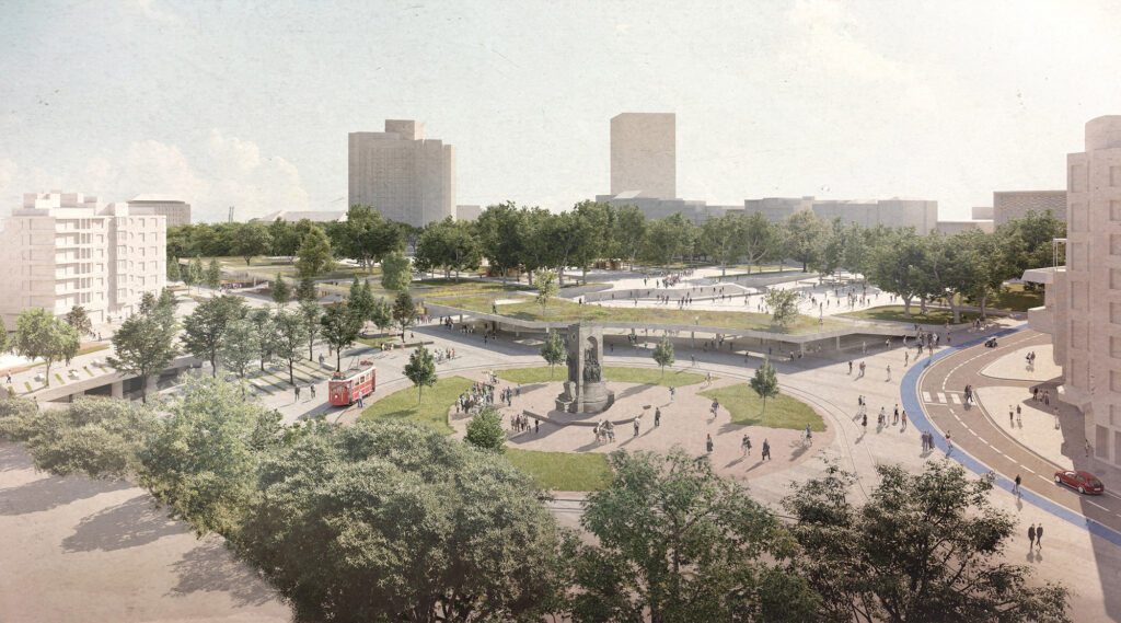
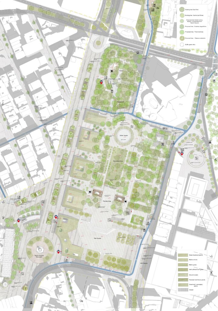
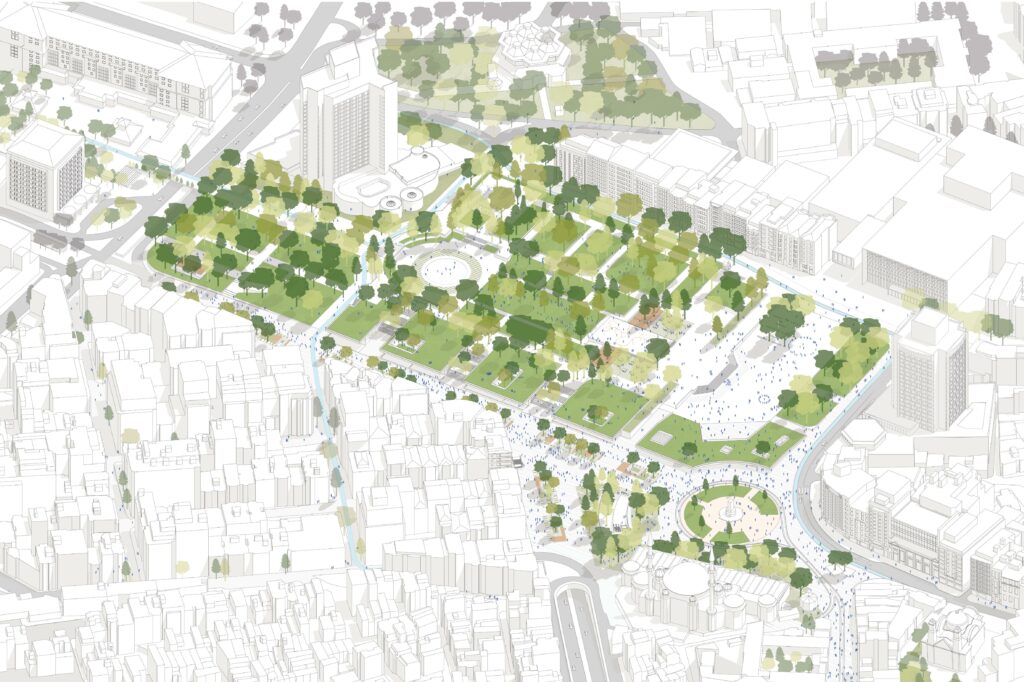
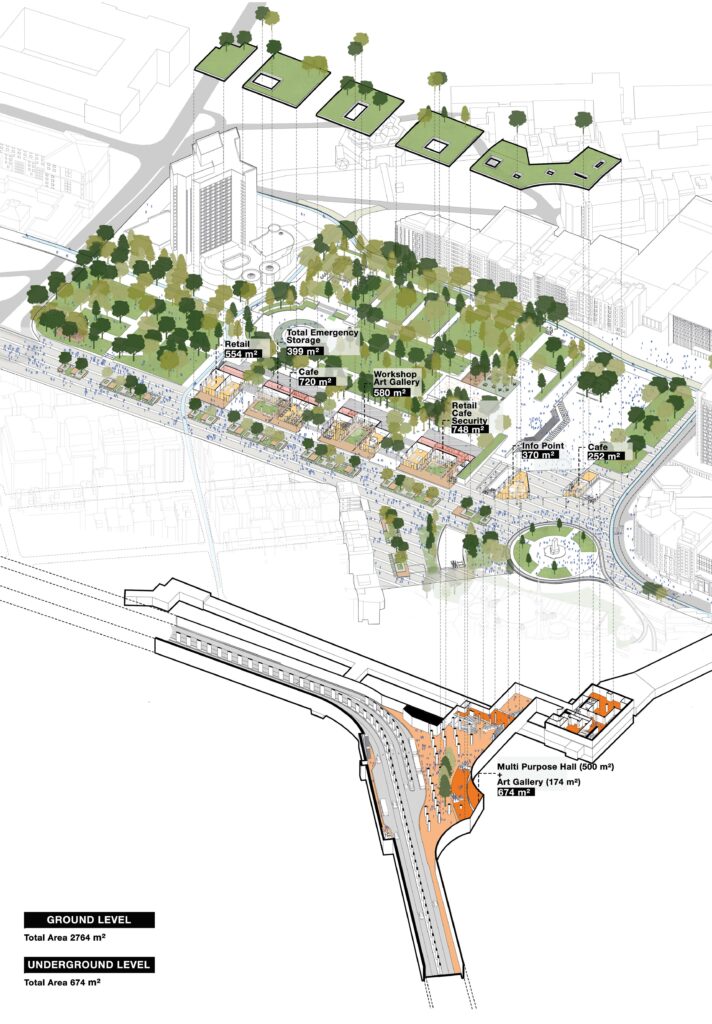
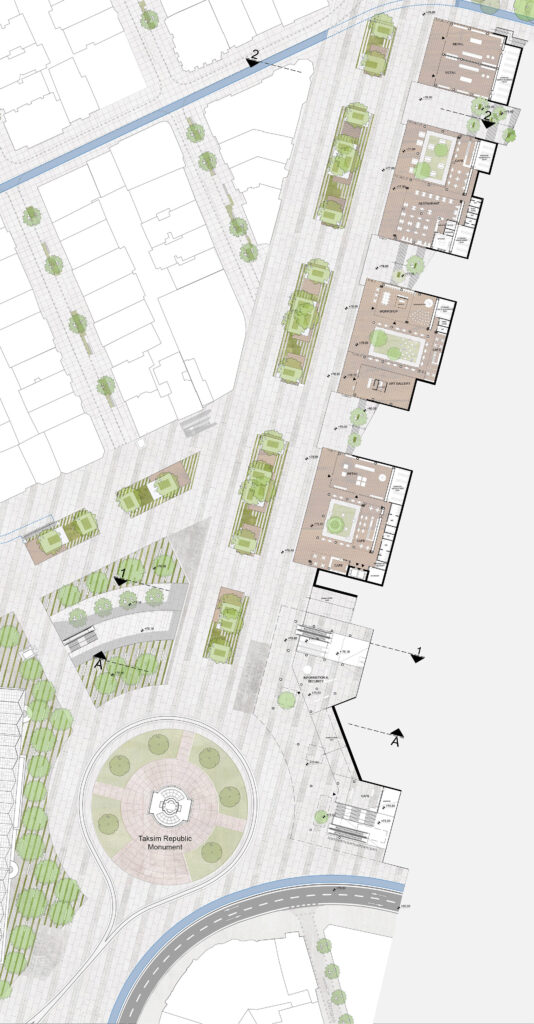
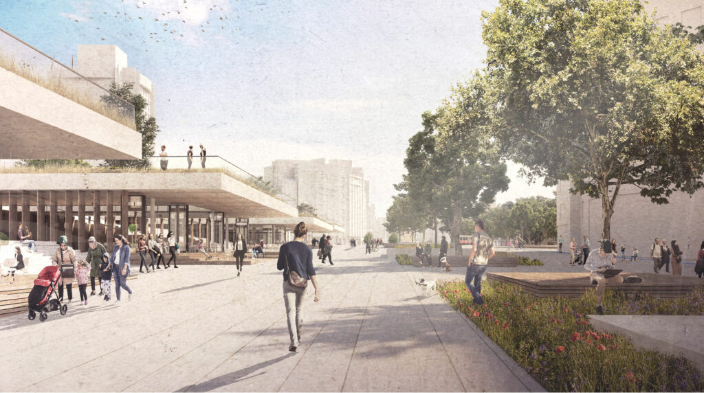
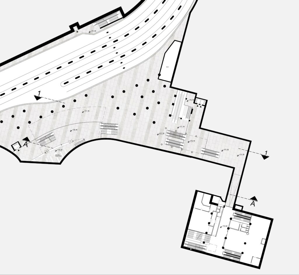
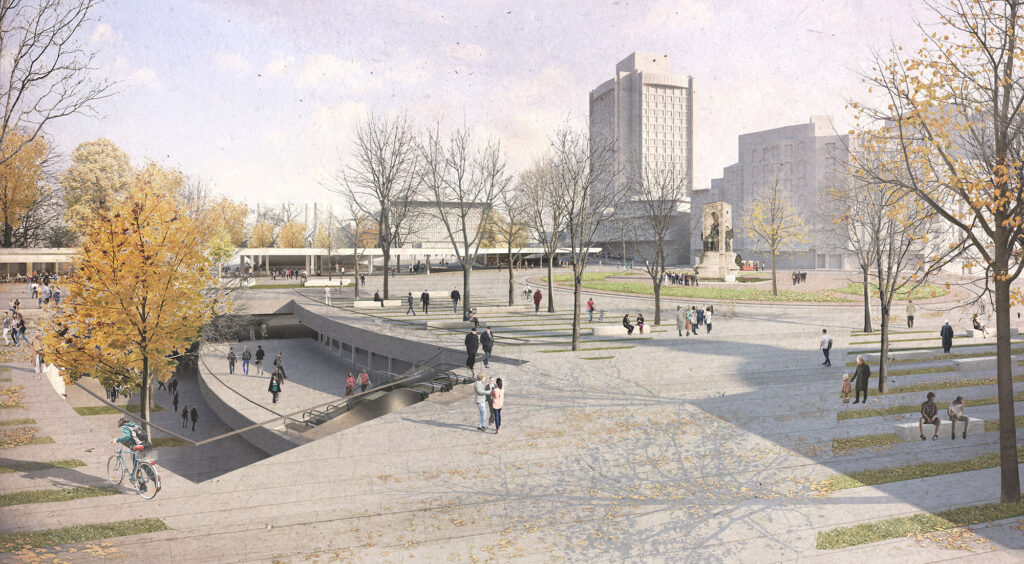
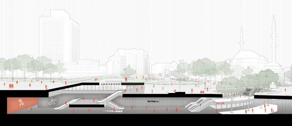
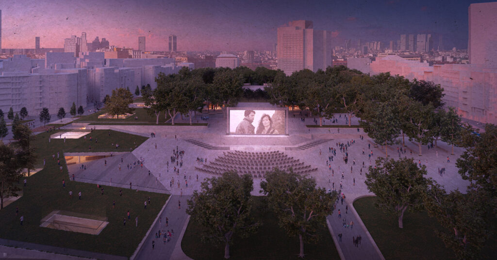
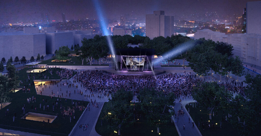
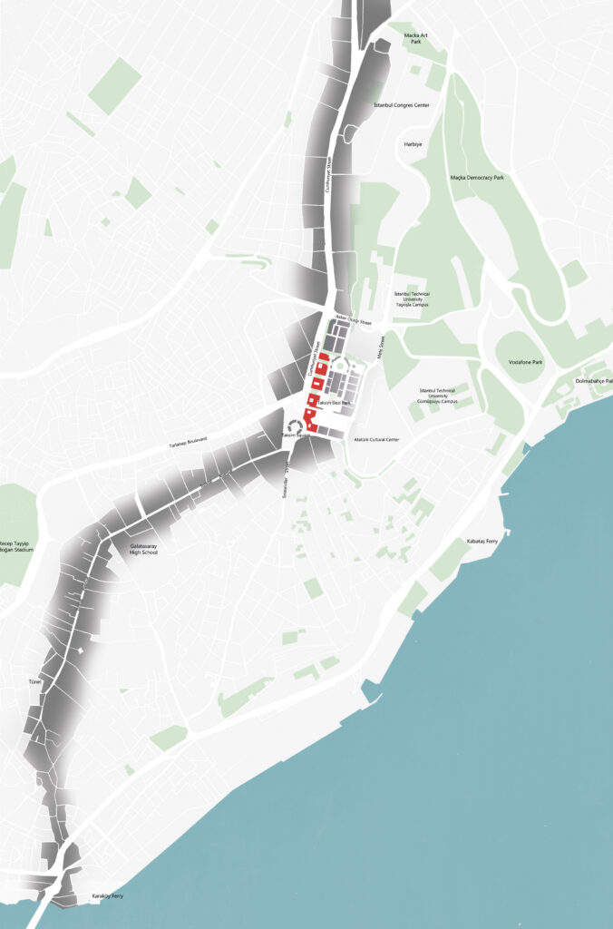
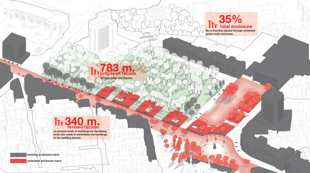
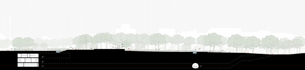
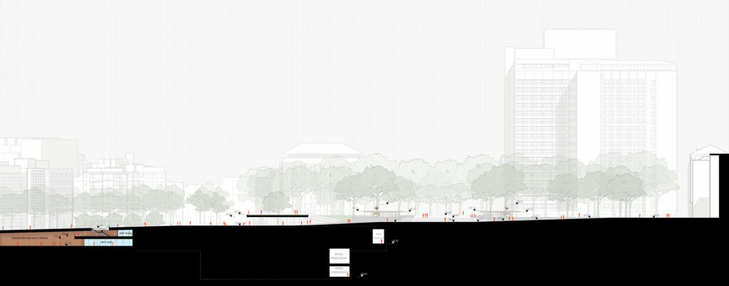
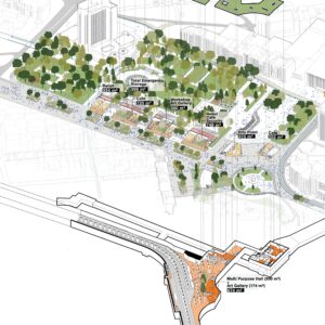
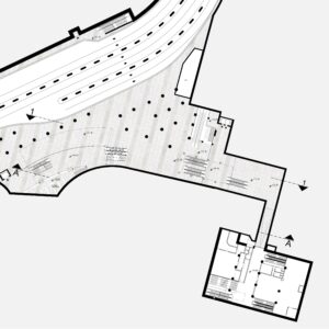
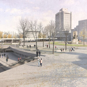
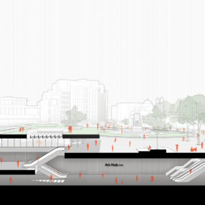
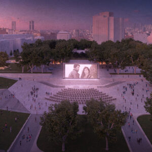
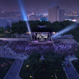
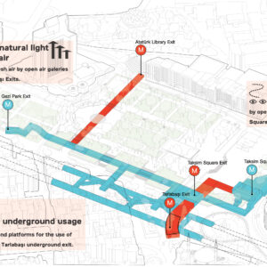
Onun yerine 1930’larda olduğu gibi tekrar meydanın sınırlarını tutacak yapılarla kentsel dokuyu yeniden üretmeyi öneriyoruz. Fakat önerilen bu ‘sınır-yapılar’ Gezi Park’ının Marmara Otel’ine doğru uzatılması ile elde edilen ‘park-yapı’lar. Böylece üçüncü boyutta da Cumhuriyet Anıtı’nın odağında oluğu yeni bir çeper elde ediliyor ve Cumhuriyet Caddesi’ni de tekrar sınırlayarak sadece isimleri kalan bu kentsel mekanları her anlamda yeniden ete kemiğe büründürüyor. Ayrıca yerüstündeki oryantasyon, ölçek ve artikülasyon sorunları yeraltı mekanlarında da devam ediyor. Söz konusu bu sorunları çözmek ve yer altı ile üstünü bağlamak adına kademeli bir galeri meydan ve yeraltındaki kurgulanıyor. Galeriye ölçek veren bu kademelerin, “Art Hub” olarak adlandırılan yeni bir sanatsal kuruluşa da ev sahipliği yapması öngörülüyor.
Introduction
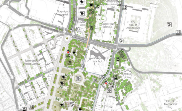
Taksim Square is the literal hub of the modernization of İstanbul. The square evolved with the characteristics of the Turkish modernization breakthrough functionally and morphologically. Definitely as one of the most prominent squares of İstanbul and the major link between Historical
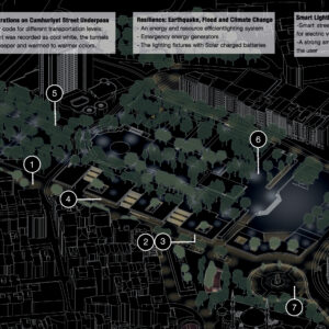
Peninsula and the economical expansion zone, it cannot remain the same from the times of 1920s İstanbul which has less than a million population to 21th century İstanbul as one of the most populated cities on the planet with more than 15 million inhabitants. The evolution of the square characterizes the modernization problems of the Turkish Republic as well; the continuous transformation in the last 50 years mostly focused on technical and economical aspects of the physical opening and mostly ignored Taksim Square’s urban, cultural and psychological features. Afterward, last 10 years focus shifted mostly to the ideological context of the Square. Today Taksim Square’s brand new ideological elements: The Taksim Mosque and New Atatürk Cultural Center are surrounded by technical oriented transportation infrastructure and for-profit facilities which are designed and located singularly and un-harmoniously. Depicted the current situation causes weaknesses for some major urban threats and the proposal is well aware of these threats for the future of Taksim Square such as possible radical neoliberal approaches, environmental resilience problems, abandonment from its inhabitants or a widespread recession caused by national or global level economical collapses.
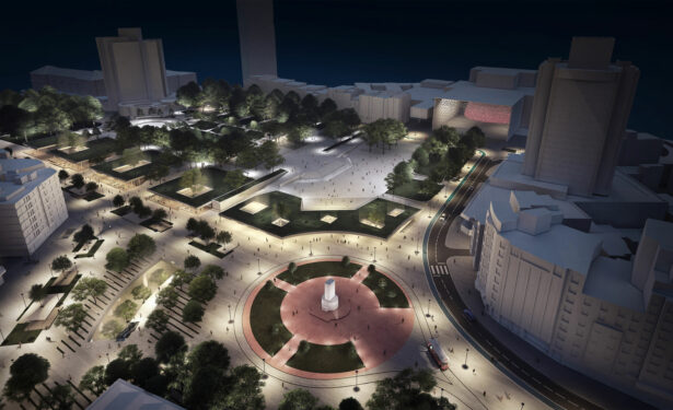
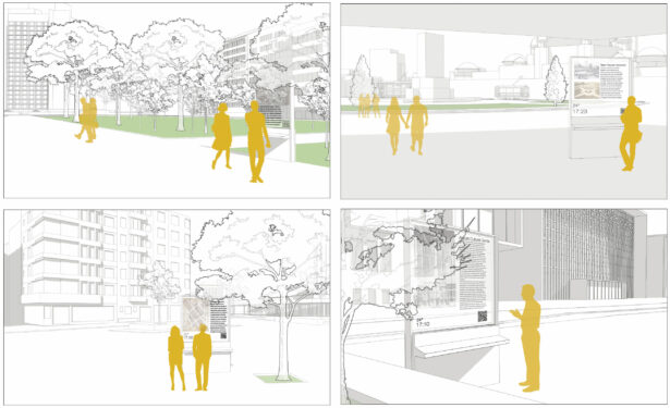
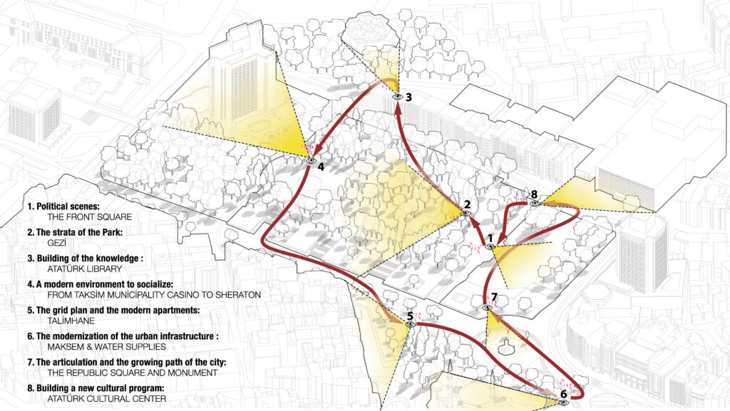
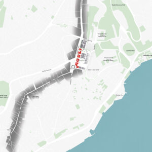
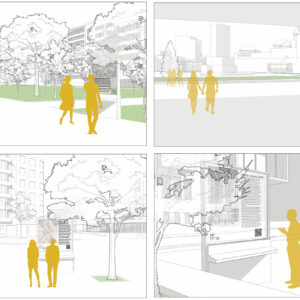
The proposal characterizes Taksim Square as an urban square genuinely and began the work with curing the problems in the contexts of sense of place, sense of memory and urban morphology to highlight its urban authenticity. When doing this, the proposal kept itself away from easy ideological engagements or ornamental solutions; it did not aim to revive a longing past but use the perspectives that identify the Square’s characteristics historically. As an example, the proposal did not try to reconstruct Prost Plan but understands its motivations and uses them to re-design the Square and its link with Maçka Park while considering contemporary aspects, necessities and limitations. As well, the proposal cares about economical investments of public and private sectors. It tries not to abolish current installments even if they are not favorable at first. As a method of sustainability, it uses and re-design them to find their potentials to be better components for the square’s harmony.
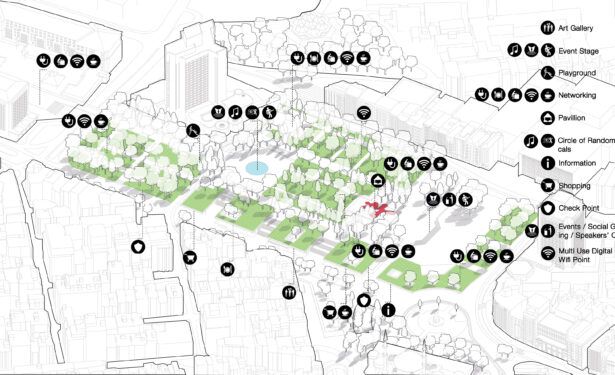
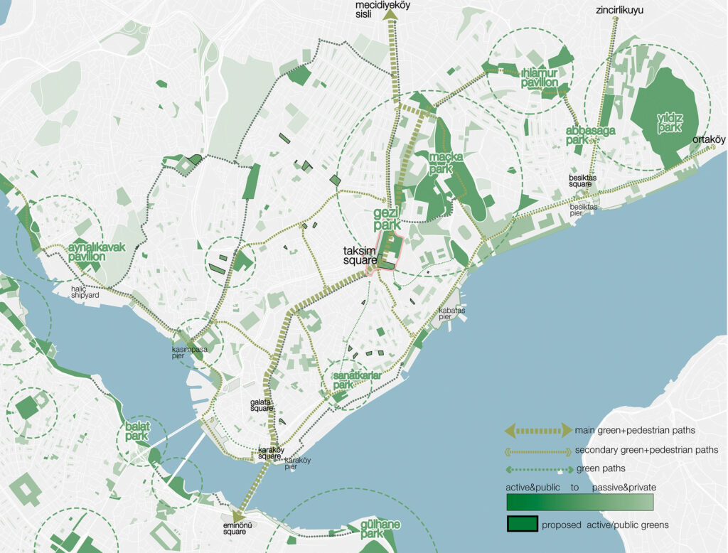
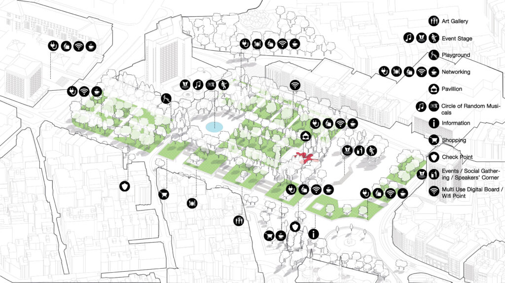
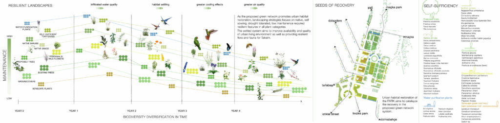
Habitat Network Strategy
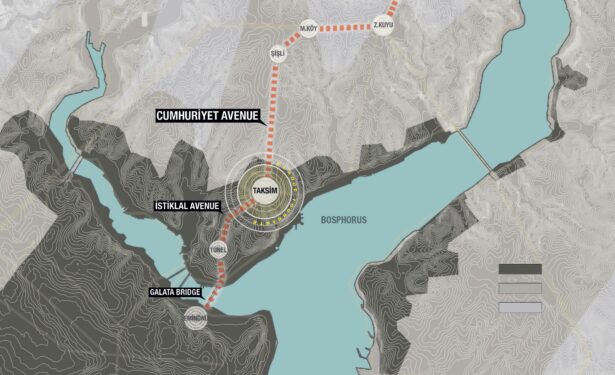
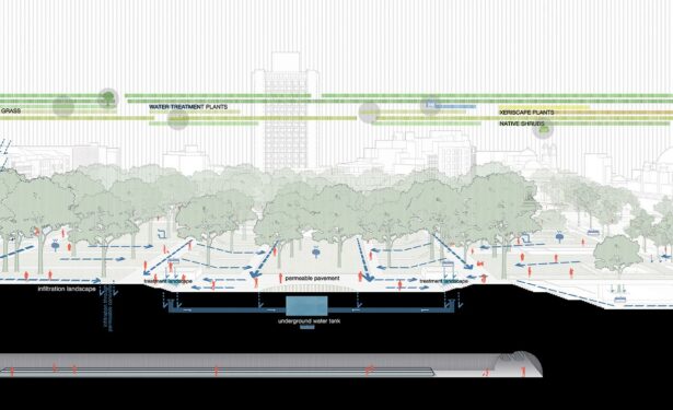
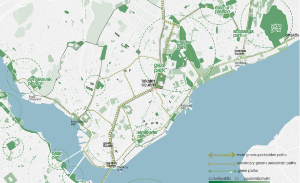
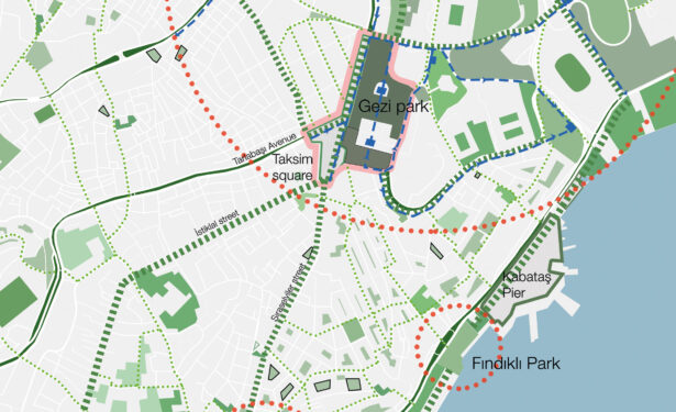
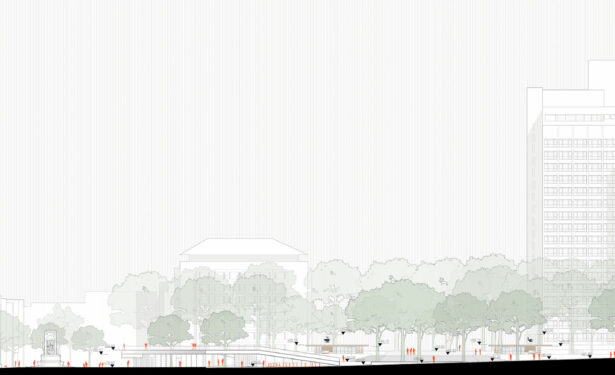
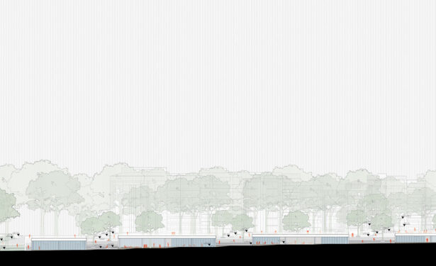
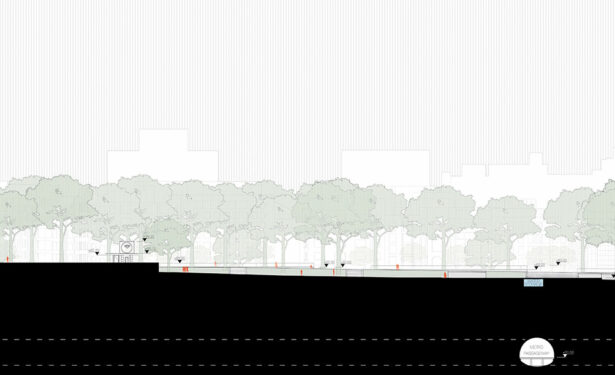
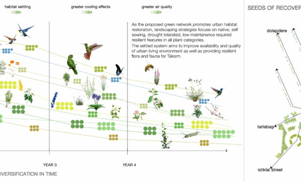
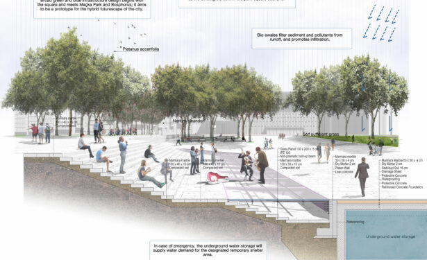
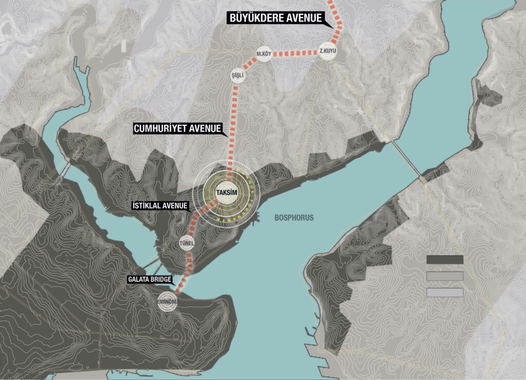
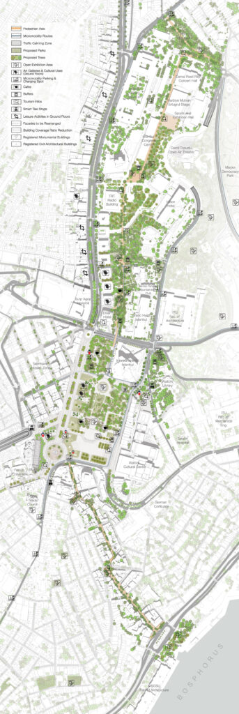
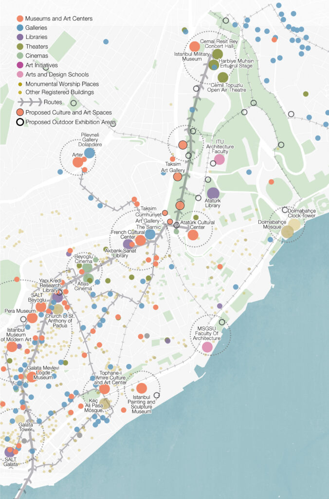
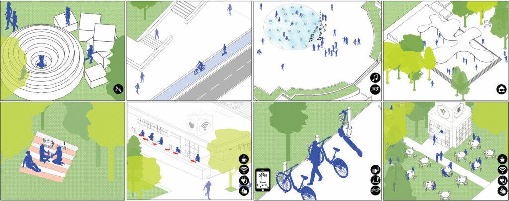
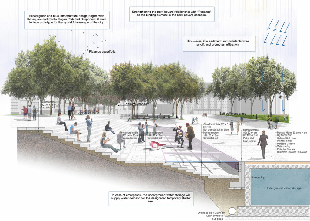
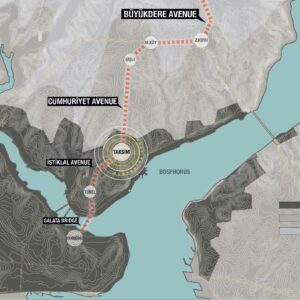
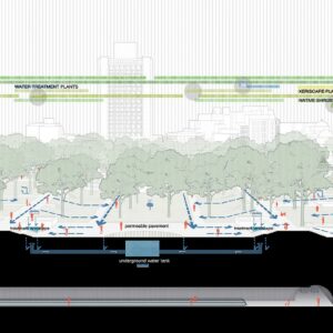
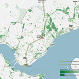
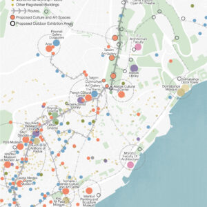
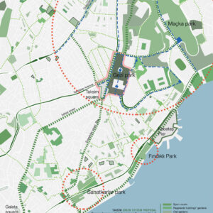
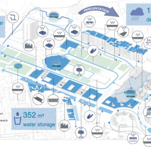
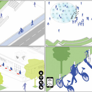
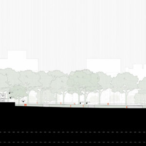
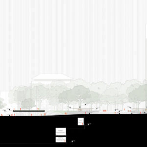
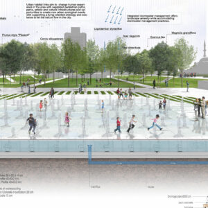
The proposal understands urban space as the milieu of living. In the midst of designing the square, it aims to create a “habitat” in a profoundly broad meaning: as a habitat in biological context, in artistic and cultural contexts and as an urban habitat for everyday life. This broad meaning is mused by continuously changing contemporary lifestyle in the city, in the semesters of the year, in day and night, now and future. Therefore the challenge is to solve these issues as one to create urban harmony and fluidity. To create this hybrid urban space, the proposal begins the work with projecting and suggesting a multi-layered socio-ecological design strategy that has perpetual green paths which are between but not limited to the Historical Peninsula in the south and Büyükdere axis in the north.
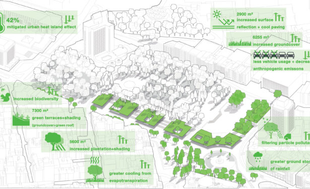
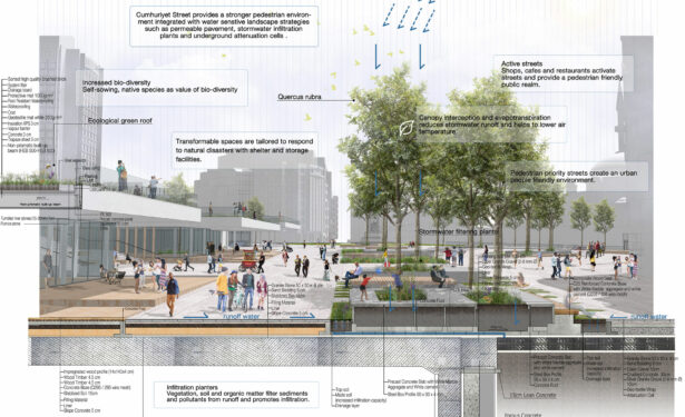
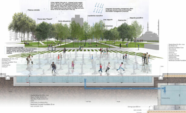
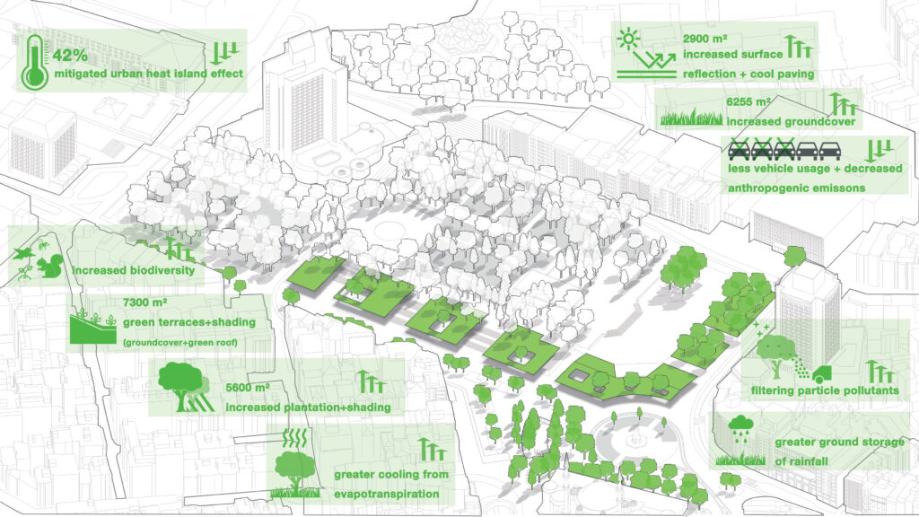
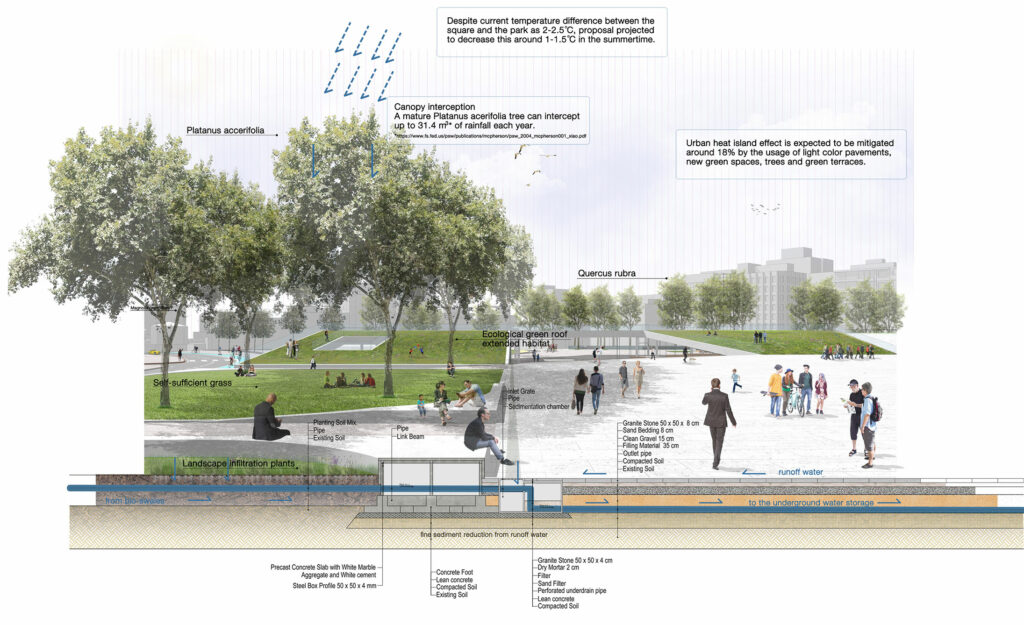
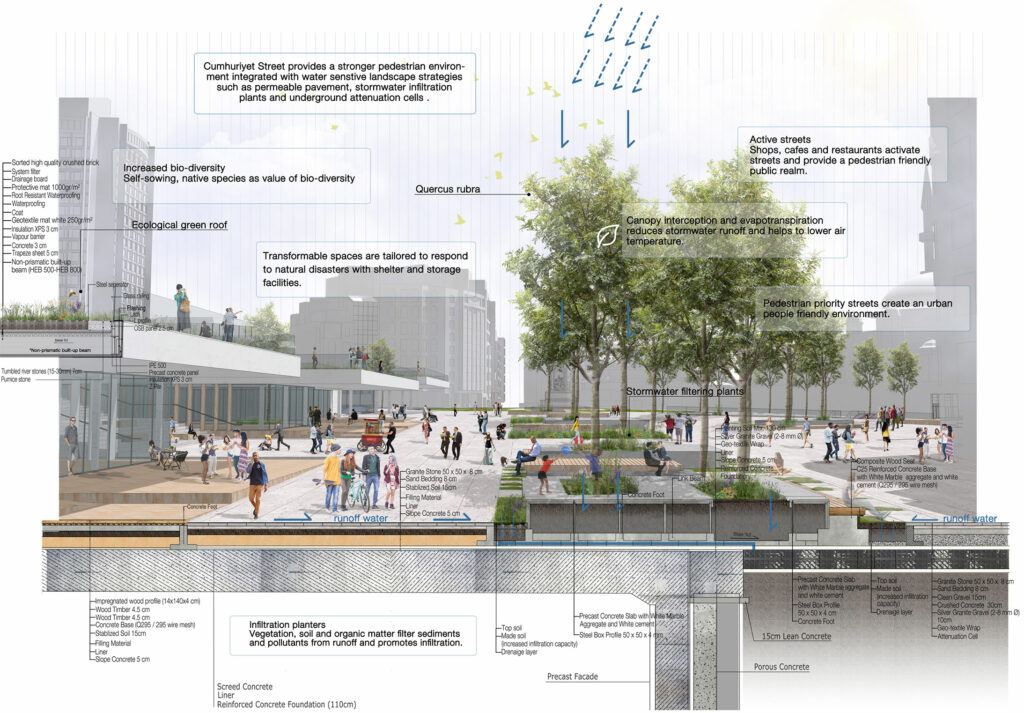
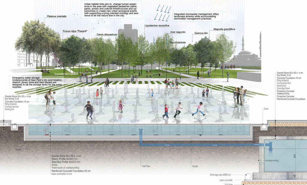
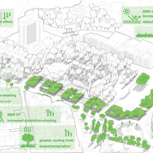
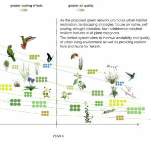
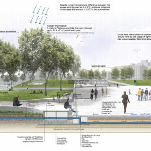
Habitat network aims to create new perspectives, metaphorically and literally. The green paths will portray new possibilities in the city. The network will not only change human experience in the area with vegetated pedestrian paths, parks, artistic and cultural infrastructures and opportunities to create new urban events but it also aims to create a living-oriented ontology and existence to let nature infiltrate the city. As experimented and experienced in other examples all over the world, habitat networks projected to boost floral and faunal biodiversity and decrease the heat-island-effect of the dense urban area.
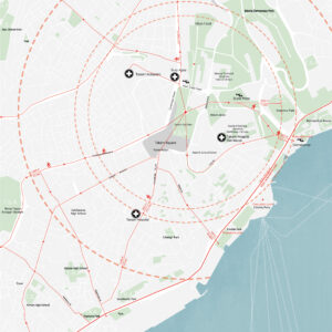
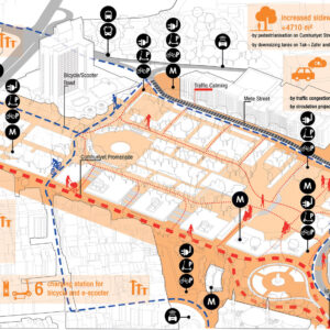
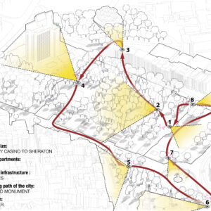
On the other hand, the proposal is well aware that there are a lot of current lost links and private investments that can be seen as obstacles for the habitat network goal. In particular, Hilton Hotel Complex blocks the Taksim – Maçka – Nişantaşı axis as a private sector investment gated zone. For these kinds of urban issues, the proposal suggests hybrid spatial solutions which are influenced by the new perspectives on urban diversity and touristic experience. The design suggests open-to-public private spaces that will be superposed and by-passed by habitat green paths. Right alongside with being ecological green paths, the habitat links will become both quality pedestrian routes mostly free from vehicle pollution and guide routes for a touristic experience which helps the profitability of the private sector investments which hold the property of the area.
Etiketler