- 4 Haziran 2026
- 2315 defa okundu.
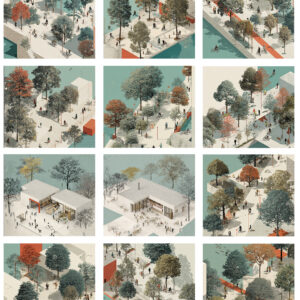
Finalist, Re-Gen Gorizia Competition
Spika Mimarlık tarafından "Re-Gen Gorizia Competition" için önerilen proje, finalist projeler arasında yer aldı.
Proje Raporu:
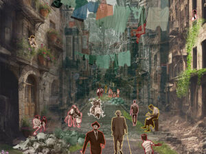
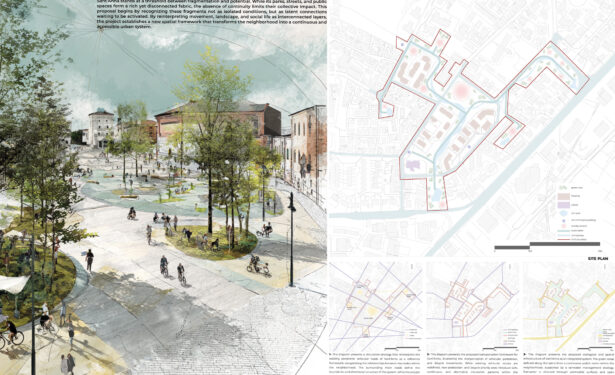
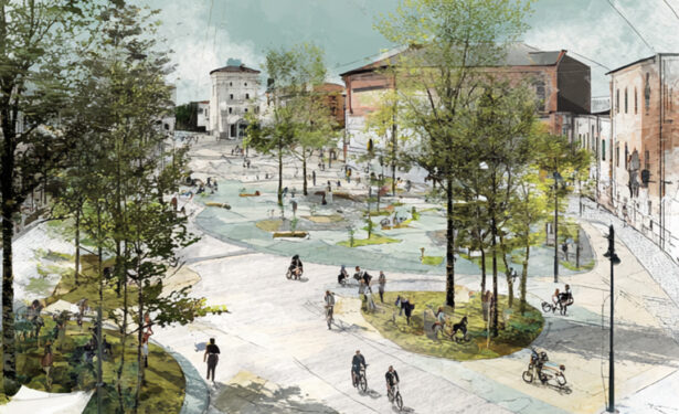
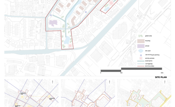
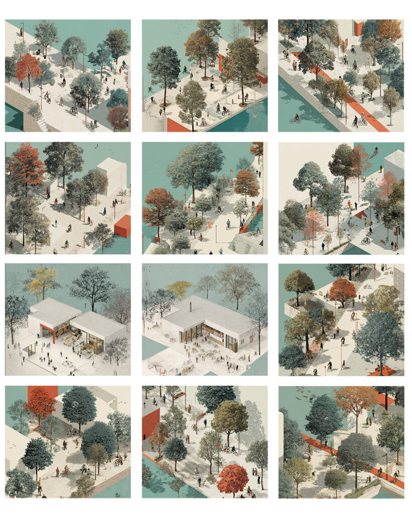
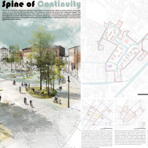
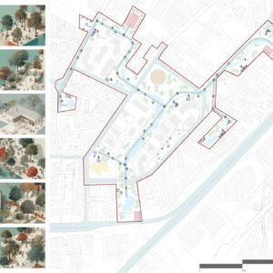
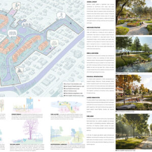
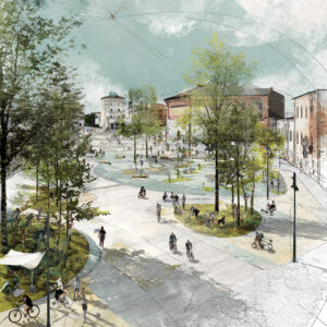
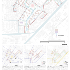
Sant’Anna bölgesinin parçalı kentsel yapısını yeniden ele alan proje, kamusal alanları, sosyal odakları ve yeşil altyapıyı bütüncül bir sistem içerisinde birbirine bağlamayı hedefliyor. Tasarımın temelini oluşturan süreklilik omurgası, mahalle içindeki düğüm noktalarını güçlendirerek erişilebilir ve okunabilir bir kentsel ağ oluşturuyor. Ekolojik altyapı, yağmur suyu yönetimi, geçirgen yüzeyler ve yeşil koridorlarla desteklenirken, kamusal mekânlar çok katmanlı ve esnek kullanım senaryolarıyla yeniden tanımlanıyor. Proje, Sant’Anna’yı sosyal etkileşimi, ekolojik dayanıklılığı ve mekânsal sürekliliği ön plana çıkaran bütüncül bir yaşam çevresi olarak yeniden kurguluyor.
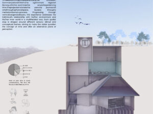
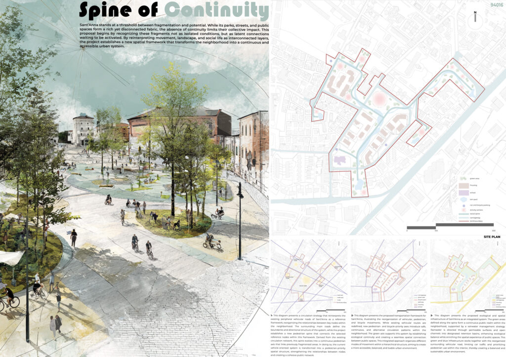
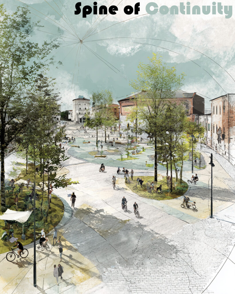
SPINE OF CONTINUITY
GENERAL CONCEPT
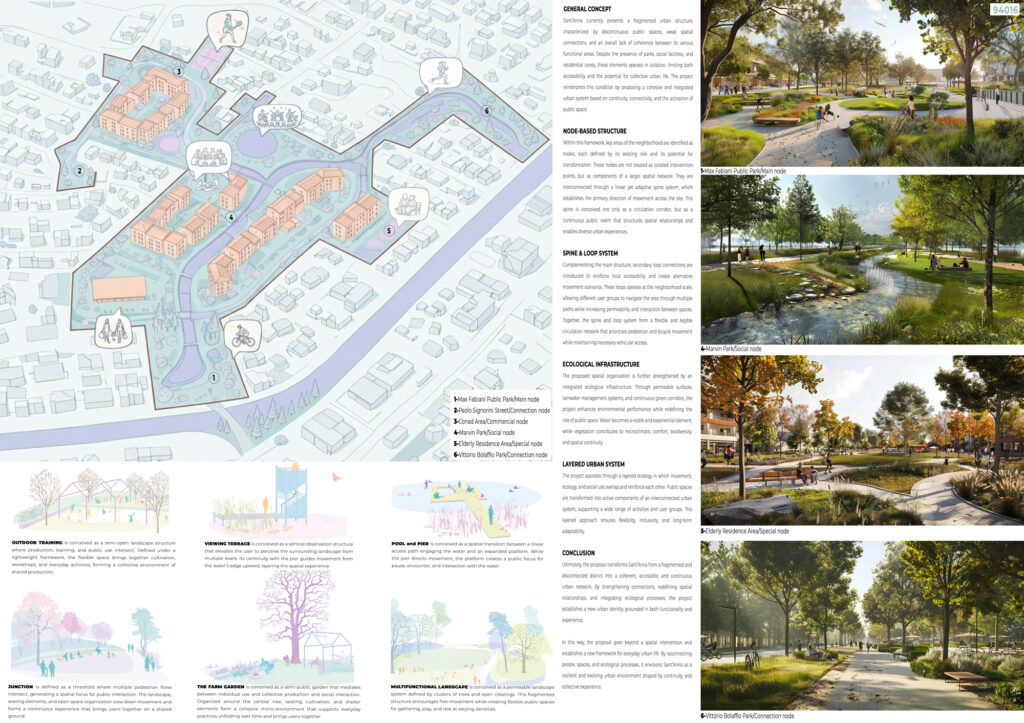
Sant’Anna currently presents a fragmented urban structure, characterized by discontinuous public spaces, weak spatial connections, and a lack of coherence between its functional areas. Although parks, social facilities, and residential zones exist within close proximity, they operate largely in isolation, limiting both accessibility and the potential for collective urban life. The absence of a clear spatial hierarchy further reinforces this condition, preventing the emergence of a unified urban identity. The project addresses these challenges by proposing an integrated urban system grounded in continuity, connectivity, and the activation of public space as a primary structuring element.
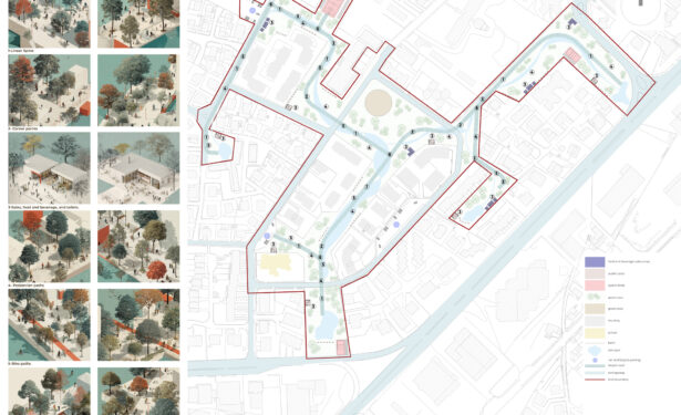
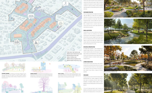
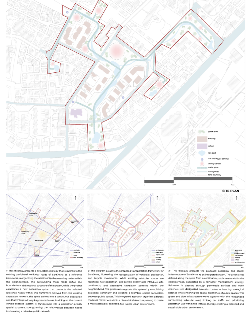
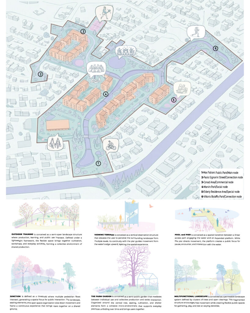
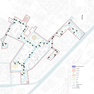
NODE-BASED STRUCTURE
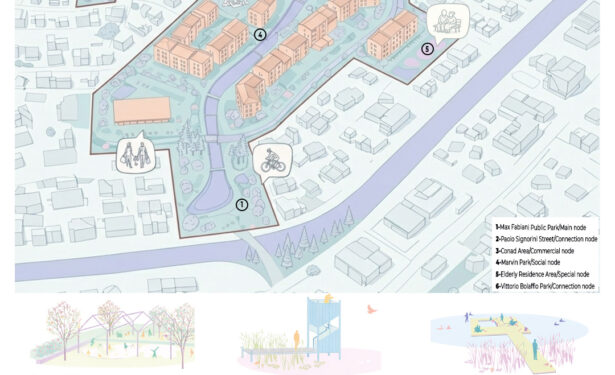
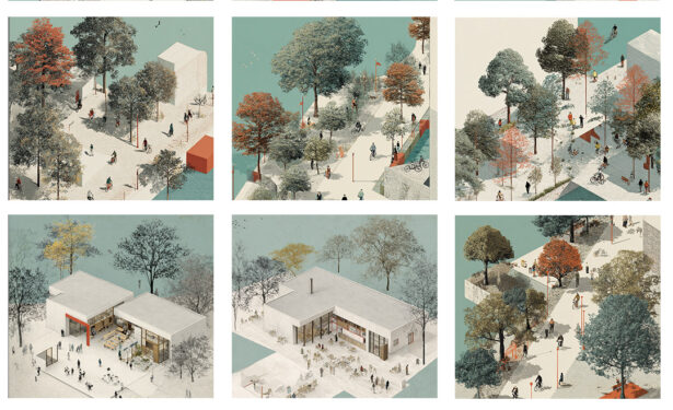
Within this framework, key areas of the neighborhood are identified as nodes, each defined by its existing role and its capacity for transformation. These nodes include social, commercial, residential, and infrastructural elements that already contribute to the daily life of Sant’Anna but lack meaningful spatial relationships with one another. Rather than treating them as isolated intervention points, the proposal redefines them as components of a larger, interconnected network. Each node is intensified through programmatic enhancement and spatial clarification, allowing it to function both as a local destination and as part of a broader urban system.
SPINE SYSTEM
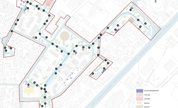
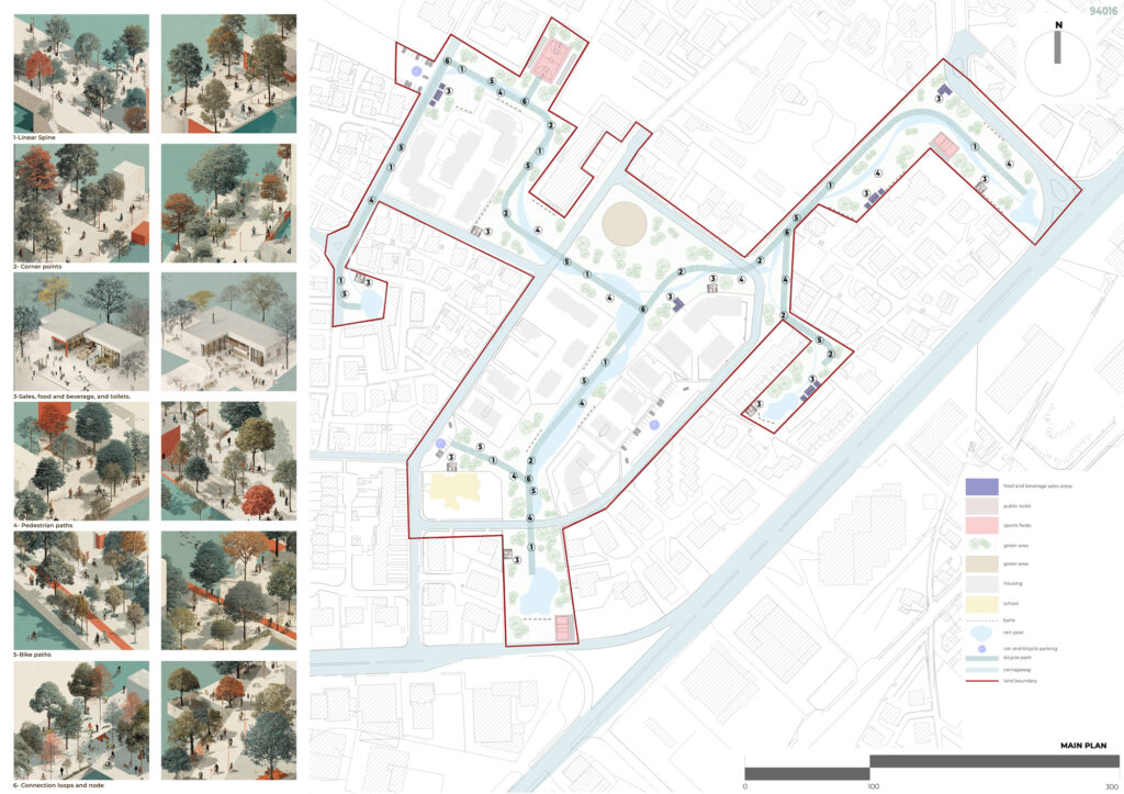
The primary spatial strategy is established through a linear yet adaptable spine that connects these nodes across the site. This spine defines the main direction of movement and acts as the structural backbone of the proposal. More than a circulation corridor, it is conceived as a continuous public realm that accommodates a range of activities, from daily pedestrian flows to social interaction and collective use. Its geometry is responsive rather than rigid, adapting to existing conditions while maintaining spatial continuity. In doing so, the spine organizes the fragmented urban fabric into a legible and cohesive system.
LOOP CONNECTIONS
Complementing the main spine, a series of secondary loop connections are introduced to reinforce local accessibility and provide alternative movement scenarios. These loops operate at the neighborhood scale, linking residential areas, public facilities, and open spaces through shorter and more intimate routes. By increasing permeability and offering multiple pathways, the loop system supports a more inclusive and flexible pattern of use. It allows different user groups to navigate the site according to their needs, while also encouraging interaction between previously disconnected areas.
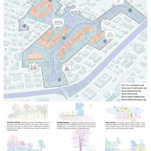
ECOLOGICAL INFRASTRUCTURE
The spatial organization is further strengthened through an integrated ecological infrastructure that operates in parallel with the circulation network. Permeable surfaces, rainwater collection and management systems, and continuous green corridors are introduced to improve environmental performance and resilience. Water becomes a visible and experiential component of the public realm, contributing to both ecological awareness and spatial identity. Vegetation is used strategically to enhance microclimatic comfort, reduce heat island effects, and support biodiversity, while also reinforcing the continuity of open spaces throughout the site.
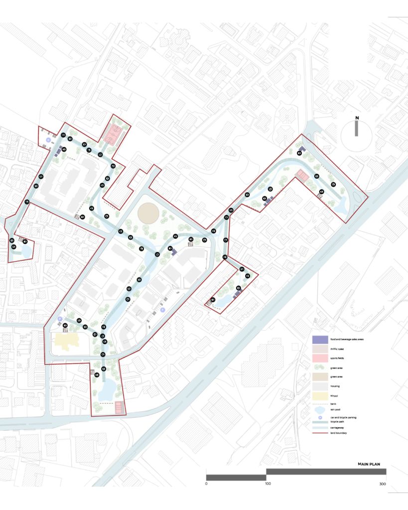
LAYERED URBAN SYSTEM
The project is conceived as a layered system in which movement, ecology, and social use overlap and reinforce one another. Rather than functioning as separate strategies, these layers interact to produce a dynamic and adaptable urban environment. Public spaces are redefined as active and multifunctional elements within this system, capable of supporting a wide range of activities across different times of day and seasons. This layered approach ensures that the proposal remains flexible, inclusive, and capable of responding to future changes.
CONCLUSION
Ultimately, the proposal transforms Sant’Anna from a fragmented and disconnected district into a coherent, accessible, and continuous urban network. By strengthening connections, redefining spatial relationships, and integrating ecological processes, the project establishes a new urban identity that balances functionality with experiential quality. It moves beyond a singular spatial intervention to propose a long-term framework for everyday urban life. Through the reconnection of people, spaces, and ecological systems, Sant’Anna is reimagined as a resilient and evolving environment shaped by continuity, interaction, and collective experience.
Etiketler